- Completed in January 2025 there is approximately 8km of surfaced Towpath between Bridge 155 (near Farleton) and Stainton (near Wellheads Lane)
- We recommend parking at the Canal & River Trust car park in Millness (near the Texaco garage off the A65). The car park is in the middle of the improved section. From the car park there is level access onto the Towpath Trail in both directions – either northwards towards Stainton or southwards towards Bridge 155.
- Travelling south, the level access ends at Bridge 155. There is a steep unsurfaced path onto the road bridge to continue following the Towpath Trail route towards Holme village. There is room to turn a wheelchair around at this point and LCRP have aspirations to install an accessible exit point here.
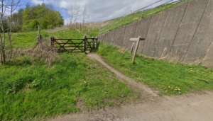
- Travelling north, the new level access ends at Wellheads Lane near Stainton. The Towpath Trail route continues around Hincaster Tunnel via the ‘Horse Path’ which is unsurfaced, very uneven, steep in places and becomes muddy after rain. The entry point for the Hincaster Tunnel area and the Horse Path is via an incline and includes a gate, please see picture below.
- LCRP, in partnership with Canal & River Trust, are designing solutions to create level access through Hincaster Tunnel to provide an accessible alternative to the Horse Path (read more here)
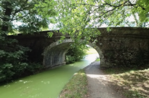
- Throughout this section the surface narrows slightly underneath each canal bridge to accommodate the existing canal bank structure. Please see the picture below to illustrate.
- The surface improvements in this section were completed thanks to funding from the UK Government via the Rural Shared Prosperity Fund and Sport England.
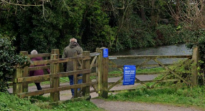
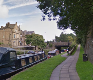
- From the city centre head toward Aldcliffe Road, which runs parallel to the canal on the west side of the city centre and provides a smooth transition from the pavement to the Towpath near the Waterwitch pub.
Parking options adjacent to the canal near Aldcliffe Hall Road are available.
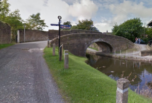
- At Aldcliffe Triangle Garden the Towpath Trail goes up and over the bridge to the other side of the canal which includes a short, cobbled section and a steep incline on both sites which may be difficult for some manual wheelchair users, please see the picture below to illustrate.
- The access ramp on to the Towpath from Penny Street Bridge is good but the surface near the Waterwitch Pub is cobbled, prone to pot holes and can be busy and therefore narrow especially during the summer months, please see picture below.
- Check out the Canal & River Trust accessibility map to choose a preferred entry and exit point within Lancaster City centre
- A Lancaster highlight is travelling over the Lune Aqueduct for great views of the city and river. We recommend parking near Woodlands Road, off Halton Road, for level access on to the Towpath. Once you reach the Towpath, turn right towards the aqueduct and continue over the aqueduct to reach the city centre.
- Access the Towpath Trail via the wide gate entrance from Whin Grove.
- Turn right to enjoy a flat surfaced section of the Towpath Trail (and the sea views!) for approximately 20 minutes
- Exit at St Michaels Lane, via the large gate shown below or turn here to return to the Whin Grove entry point.